Historical Perspectives on Toronto Planning

A Planning Historian's Views on Toronto's Current Issues

Of Robert Burley’s Photographs, Park Planning, and Wilderness Degraded

It has been nearly a year since I first saw Robert Burley’s magnificent photographs of Toronto’s ravine parks at the Aird Gallery, part of the Contact Photography Festival in May 2017. Burley somehow manages, through the compositional magic that gifted photographers all possess, to turn plain, everyday reality – roads, trees, people – into images of transcendent beauty. I have been loosely following his work for over thirty years, and it is always excellent, but this series struck me as particularly outstanding. There is a hard-cover book accompanying the project as well, An Enduring Wilderness: Toronto’s Natural Parklands – a fine work on its own, with excellent reproductions of the photographs and several short pieces of writing by Toronto authors who have some connection to the parklands.

Robert Burley, “Humber Marshes at the mouth of the Humber River, 2016”

Like many Torontonians, I know these ravines as an occasional walker of their paths. But I know them also as a planning historian. And these ravine parks are unmistakably the product of planning, having been conceived by Metropolitan Toronto planners in the 1950s as the city expanded out into its rural hinterland. Their planning pedigree has long been obscured by the ineradicable urban myth (thankfully, not repeated by Wayne Reeves in his essay in the book) that they exist on account of Hurricane Hazel, the storm that inundated the Toronto region with nearly a foot of rain over two days in October 1954, to devastating effect. The storm certainly expedited implementation of the parks plan. It prompted the local conservation authority to purchase much of the region’s flood-prone ravine land, forestalling any future development of it, and then to put most of this land – at least that which lay within the boundaries of Metropolitan Toronto – into the hands of the Parks Department for development into public parks. But the idea of ravines as public open space pre-dated Hazel.

The idea of using the city’s inner ravines as a public greenbelt, first formally proposed in a 1943 city plan, was picked up and promoted in the early 1950s by the the Humber and Don River Conservation Authorities. (From a 1953 report, Toronto Public Library)

The planners’ vision was to develop these lands into a rather novel type of recreational space they labelled ‘metropolitan parks’ – larger than city parks but smaller than provincial parks. They would be like city parks in that they would be within the urban area, adjacent to residential neighbourhoods, and be served by public transit. But they would be unlike city parks in that they would be left in a natural state, with wilderness trails and natural picnic areas but minimal landscaping, no significant built structures, no playgrounds, and no playing fields for active games. Since they were meant to attract visitors from a fairly wide area, they would have ample parking lots, which most existing city parks, having been laid out several generations earlier, did not have.

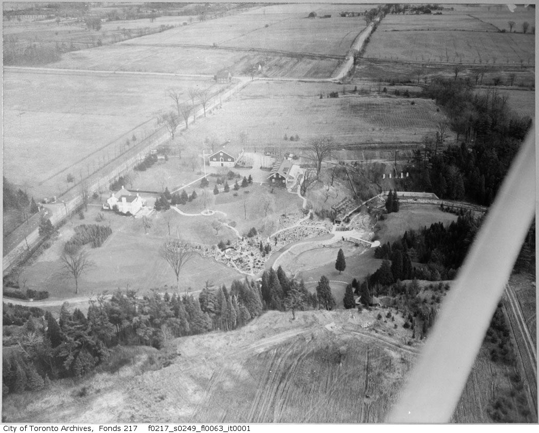
Aerial Photograph of Edwards Gardens, Wilket Creek Ravine, c.1957. Metropolitan Toronto purchased this landscaped garden from the private owners who had created it, and subsequently expanded it into a large public facility. (City of Toronto Archives)

Maybe this vision was fanciful from the start – can city and non-city reside is such proximity? – or perhaps it worked at first but no longer does, the ravines having been debased by decades of human endeavour around them. But the truth is that Toronto ravines are not wilderness. One cannot literally get lost in them, at least not for long – notwithstanding Mr Burley’s charming anecdote in his introduction – for one need only look up and see the viaduct to get one’s bearings. That is not to say they lack value as public space. Their distinctive semi-natural quality – not entirely inappropriate for an urban park – gives them plenty of charm and appeal.

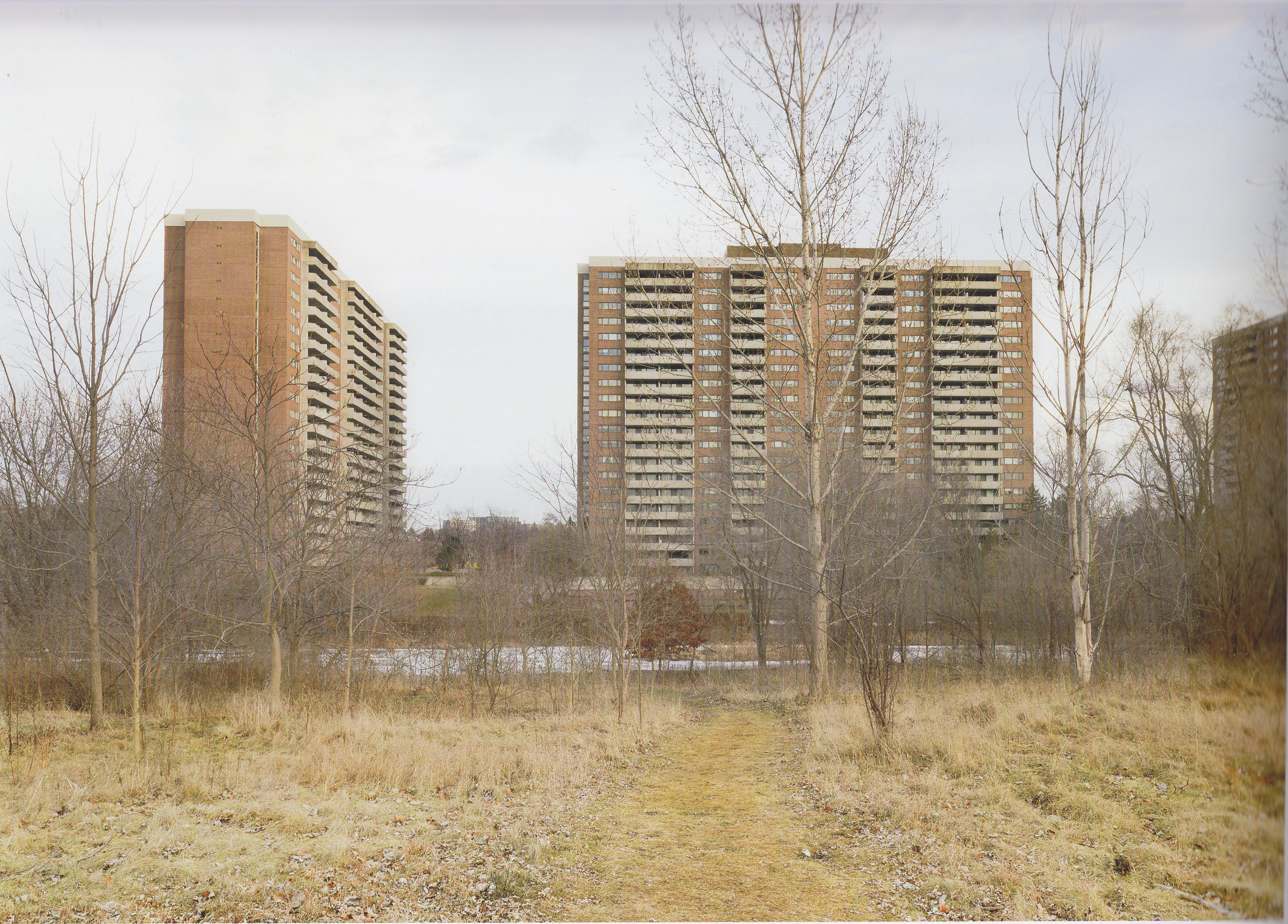
It is also an essential ingredient of Burley’s photographs, many of which contain a subtle tension between the natural and non-natural; subtle because in Burley’s non-judgmental, humanistic hands the tension is touching rather than critical or ironic, but unmistakably present nonetheless. “Lower Don River” shows us not just a silent swollen river but six lanes of noisy speeding traffic alongside it. Paging through the book – the title of which is Enduring Wilderness – one sees towering bridge piers in “Couple, Humber River, Lambton Park”, imposing electrical poles and lines in “Footpath, Lower Don Parklands”, and massive highway infrastructure in “Fishing Beneath the Macdonald-Cartier Freeway, Rouge Park”. There are the overwhelming “Rail and Traffic Bridges, Humber River”, the feral, non-native “Catalpa Tree, Sunnydene Park”, and the degraded “Cormorant nesting area, Tommy Thomson Park”. And then there are the high-rise buildings, some front and centre and some in the hazy distance, in what seems to be every second image

Robert Burley, “Scarlett Mills Park, 2015”

There is, admittedly, plenty of pure nature in his images, from the simple, elegant “View of Lake Ontario from Cudia Park” to the rich, complex “Black Locust among Sumacs, Sylvan Park”. But those of us who have stood in locations such as these might recall, if we cast our thoughts back, the exposed culvert of an altered watercourse just out of view, the rumbling traffic on a bridge overhead, or the faint but pervasive odour of a not-too-distant sewage plant. This is an in-between landscape, somewhere between pristine and disfigured, perhaps even, as Leanne Betasamosake Simpson portrays it in “Life By Water”, a landscape of nature degraded, a tamed, almost lifeless wilderness.

What then of the special, almost spiritual significance they are supposed to have in Toronto life? In the oft-repeated words of Robert Fulford “the ravines are to Toronto what canals are to Venice and hills are to San Francisco”. This has always struck me as a bizarre, rather boosterish claim that is hard to take seriously. Do tourists come to visit the Vale of Avoca? Has Morningside Park been the foundation for centuries of commerce and industry? In her book Imagining Toronto Amy Lavender Harris does show that, over the years, writers of Toronto-set fiction have used ravines as metaphors for mystery, danger, or escape – interesting, and understandable, since they are a distinctive feature of Toronto’s physical geography. But whether this makes them, citing Fulford again, “the heart of the city’s emotional geography” is another matter.

Do Torontonians love and flock to them? Not that I can see. In my neighourhood’s local ravine on a pleasant Sunday morning I might pass in total a dozen walkers, nearly all of them with dogs, but none of my immediate neighbours ever seem to walk there and none has ever spoken of it. I cannot imagine any of them making a deliberate excursion to a larger ravine park, as the planners of the 1950s imagined we would do. And whenever I do I usually find the parking lots barely half-occupied and the nature trails lightly used. Burley’s compositions often include people – walkers and runners, paddlers and fishers, stone-skippers and beach-combers – but mostly in threes and fours. As the heart and soul of a city of nearly three million, Toronto’s ravine parks, all told, are curiously under-populated.

Robert Burley, “Williamson Park Ravine”, 2016

Contrast this with conventional surface parks – think chock-full Trinity Bellwoods on a summer day – and reflect on the fact that the City, facing a shortage of inner-city parkland, is seriously considering spending nearly $2 billion to build a new park on a huge deck atop the lakefront rail corridor. All the while the ravine parks remain little used. As much as I enjoy the ravines’ curious in-between landscape, and as much as I swoon over Robert Burley’s photographs of it, I wonder if these ravine parks are truly serving the public. I begin to think that the planners’ notion of ravines as natural, un-developed, un-landscaped public open spaces woven into the urban fabric, appealing as it was in the parsimonious 1950s and sacred though it may be in the environmentalist present, has not aged well. And then my mind fills with heretical thoughts: some public authority taking inspiration from the fearlessly interventionist landscape designers of the mid-nineteenth century (think Olmsted’s splendid Delaware Park in Buffalo), admitting the truth about the impact of human activity on these ravines, and bringing in landscape designers and bulldozers to create beautiful public spaces that the public can and will use and enjoy.

SOURCES

Robert Burley is represented by the Stephen Bulger Gallery in Toronto. He introduces this project on his website at http://robertburley.com/an-enduring-wilderness/. The accompanying book is published by ECW Press, 2017. The Wayne Reeves essay in it is “Imagining, Creating, and Sustaining Toronto’s Natural Parklands, A Short History”, 221-29; Leanne Betasamosake Simpson, “Life by Water”, is 102-03. The plan for metropolitan parks was never released as a stand-alone report, and exists only in the Metropolitan Toronto Council Minutes (Report 1 of the Planning and Parks Committee, 21 February 1956); its main elements appear in Chapter XI of the Metro Planning Board’s “Official Plan of the Metropolitan Toronto Planning Area” (1959). Amy Lavender Harris’s book is Imagining Toronto (Mansfield Press, 2010). The Buffalo Olmsted  Parks Conservancy maintains information on Delaware Park at https://www.bfloparks.org/parks/delaware-park/


Advertisement

Of History and Historical Preservation

A blog written specifically for Active History and posted on their site over a year ago (3 February 2017), now being re-posted here. It’s not about planning, directly, but it stirred up interest among planners so it seems to belong.

Some ten or fifteen years ago a group of residents in my Toronto neighbourhood, a pre-WWI ‘streetcar suburb’ known locally as the Beaches, began the process of making parts of it a Heritage Conservation District, a designation that would impose controls on physical changes to buildings. My immediate response was to oppose them. I was not entirely sure why, and I was somewhat surprised at my own reaction. I enjoyed the ambience of our hundred-year-old streets, as well as the many conveniences that come from pre-automobile residential densities, but the idea of a municipal bylaw freezing these physical qualities in place seemed wrong.

The initiative died within a year or two. The City found, through formal surveys, that more residents opposed than favoured it and took no further action. My street was saved from the preservationists and, as things have turned out, recently acquired a splendid new modern home – all flat and square – on a double lot formerly occupied by a 1940s house.

But the experience lived on in my own mind as I pondered why I, as a historian, should have opposed the initiative. History and preservation always go together, as do historians and preservationists. Nearly all historically-minded people I know are heritage advocates. Every ‘historical association’ I have ever encountered exists to preserve the past. Indeed, a group called the Toronto Historical Association gives as its mandate “educating, researching, protecting and advocating for heritage in Toronto”. But why should this be so? As I reflected on it, I began to realize that I opposed preservation because I was a historian.

St L Map

Boundaries of the recently-designated St Lawrence HCD – a somewhat more conventional heritage district in that it includes numerous heritage buildings, some already individually designated, and the city’s ten-block founding street grid. (City of Toronto)

An urban neighbourhood undoubtedly speaks to us about the world in which it was made. Indeed a foundational principle of urban landscape studies is that the built environment is essentially a large, three-dimensional historical source. And sure enough, to those who take the time to look, houses in my early-twentieth-century neighbourhood reveal: a parsimonious new middle class (houses are small), members of which did not yet have cars (no space between houses for driveways), whose families were large (bedrooms were small), who did not overindulge in personal hygiene (one bathroom per house), were ambivalent about natural light (few windows), and wore sweaters indoors in winter (minimal insulation). The houses themselves have an unimaginative standard design, show competent if unrefined workmanship, and are adorned with occasional mass-produced touches of elegance – all of which reflect the social class for which they were built.

But that is not us. So far removed are we from Edwardian Toronto that one cannot begin to count the differences. Why then do we want to preserve and inhabit the homes that ‘middle-class’ Edwardians built?

First of all, we do not, really. Owners of these charming old houses knock out walls to create fewer bedrooms (for smaller households), build bathrooms on every floor, increase the size of water-supply pipes, park (multiple) cars on front and back yards, build decks for al fresco dining, punch holes in walls for windows, insulate like mad, re-wire to permit greater electricity consumption, and so on – all of which is permissible because Heritage Conservation District designation, according to provincial law, prohibits the alteration of “any part of the property, other than the interior.” So the truth is that we want our houses to look like, but certainly not to function as, they did a hundred years ago. As a historian who knows and cares about the past this all seems a little dishonest.

Hist Cons 1

A nicely-restored, well-maintained residential Street in the Cabbagetown-Metcalfe HCD, 2002 (City of Toronto – City Planning / Urban Design / Cabbagetown-Metcalfe HCD)

But I would go even further and say that superficial preservation actually distorts history by papering over the austerity and insecurity of early 20th century life with a tableau of present-day comfort and security, and I think this is what irks me most. It is so easy to forget, when strolling along a nicely-preserved, pre-WWI Toronto street, that nearly every original family in those houses would have experienced an infant or childhood death. Admittedly, exterior fronts of houses do reveal something about the period in which they were built – architectural façadism has its defenders – but it is the interiors, blithely gutted and tossed into disposal bins, that really show the values and customs of the time they were built. I also cannot escape the fact that the urban landscapes we seek to preserve are but a single historical moment. Even setting aside the centuries-old presence of Wendat or Ojibwa people in my neighbourhood, which is important but hard to determine, what of the entire 19th century when my neighbourhood was farmland? Why should the construction of a residential suburb in 1910 be the immortalized moment?

Hist Cons 2

Housing in the Lyall Avenue HCD – a distinctive upper-middle class street in East Toronto, early twentieth century. Its large brick houses on large lots stand apart from the much smaller lower-middle class housing around them, and seem more like housing in a small Ontario town than Toronto. (City of Toronto – City Planning / Urban Design / Lyall Avenue HCD)

We are, in truth, a people of smart phones and engineered wood, of automobiles and expanded horizons, of individuals more than of families, of unprecedented affluence and cleanliness, too busy to actually sit on our porches, and whose children would rather play indoors than out – and I see few, if any, signs of us abandoning these newly-acquired customs and values. Is there not something unsettling – especially to a person who knows the past – about our desire to preserve the appearance of another age’s built form, and our reluctance to outwardly express our own? Interestingly, they who made the urban landscapes we now strive to preserve were not so equivocal. They felt no need to shore up and retain the shacks and farmhouses they were supplanting, or to fence off and preserve disused barns in the midst of new residential suburbs. In doing so they left clear evidence of who they were, and we historians benefit from their forthrightness. Perhaps, to take this to its logical end-point, we are showing who we are to future historians – a conflicted people, trying obsessively to preserve a world we have lost as we immerse ourselves in a world we do not trust. But I have never heard that as the rationale for preservation.

Complicating matters further is that, for the most part, preserved neighbourhoods are gentrified neighbourhoods. Looking over the list of Heritage Conservation Districts on the City’s website – which, among other things, reveals how widespread preservationism has become in Toronto – it is clear that tony neighbourhoods led the way. This is not surprising. Preservationism is easier to espouse when one can afford to care more about the authenticity than the cost of brass house numbers or wood mouldings. Preserving the historical features of a house undoubtedly costs more than not preserving them, so preservationism is bound to have a stream of social inequality running through it.

The troublesome manifestation of this is that preserved/gentrified neighbourhoods are showing themselves to be rather unwelcoming to outsiders. This, to my knowledge, has not been empirically studied, but it certainly seems to be so. Perhaps preserved houses turn over less often on account of their owners’ pride of ownership, or perhaps they cost more, or maybe prohibiting the intrusion of multi-unit residential buildings prohibits the entry of newcomers. The only part of Toronto I have observed in detail in this regard is Saint James Town, where preserved South SJT is occupied (at low density) by reasonably affluent gentrifiers – many of them ‘old-stock Canadians’ – while the towers of SJT proper, always held up as what NOT to do in cities, are home to thousands of lower-income renters, many of them immigrants. Surely there is no necessary connection between preservationism and xenophobia, but the similarity of their outcomes cannot be overlooked.

Hist Cons 3

Cottage-style row housing dating from the 1880s on Draper Street, an HCD designated in 1999. The designation keeps new construction at bay, even in a downtown commercial district such as this near King and Spadina. (City of Toronto – City Planning / Urban Design / Draper Street HCD)

Where do these ruminations lead? I, for one, certainly do not want to see the whole city rebuilt with square flat modern structures – if that is indeed the built form that expresses our 21st century urban culture. I enjoy the old city as much as anyone. Moreover, I note that notwithstanding the demand for HCD designations by property owners the City itself is not doling out designations improvidently, and the studies on which designations are based seem very thorough and the recommendations they make perfectly level-headed. Current policies seem not to have put us on the road to ruin, as far as I can see.

Yet I find it unsettling, as both a historian and a citizen, that so much of the city wants to preserve itself – we have, after all, inside-the-walls Paris to remind us what happens when an entire city becomes a protected historical landscape – and I believe that there are reasonable, historically-informed arguments against preservationism. One of the miraculous things about complex ecosystems, cities included, is that the multifarious forces within them, left on their own,  seem capable of finding their own balance. Perhaps we should not worry so much about letting the present express itself.


The Unplanned Migration (Again)

(A updated version of an earlier blog, reworked for posting on Active History, 11 January 2017)

As anyone who lives in or frequents Toronto’s inner-city can attest, the place is over-run with human activity. The word “congestion” may be over-used in urban affairs, and it still feels tainted by its long association with slum clearances, but it is the word that comes to mind when travelling about the city’s lower downtown these days. Walking is usually the fastest way to get around – certainly faster than streetcar, taxi, or automobile travel, though perhaps not faster than bicycling for anyone willing to face the risks – though walking can be frustrating, and even dangerous, when the sidewalks fill up like rush-hour subway cars, and in any case one or two kilometre hikes are not for everyone.

Congestion-related problems appear in the local news almost every day. Most recently is the alarming increase in motor vehicle accidents involving cyclists and pedestrians. But others crop up regularly: unreliable electricity supply, insufficient public libraries and schools, conflicts over land use (dogs vs children, residents vs clubs), and of course the endless problem of surface public transit which, in truth, barely functions. At times the situation seems perversely amusing, but at other times truly alarming – deleterious consequences multiply, and policy solutions are nowhere to be found.

streetcar-congestion

To get on on not get on – a common downtown Toronto conundrum


Viewing this through the lens of history reveals an intriguing, and perhaps rather surprising, parallel between this recent growth in the inner-city and the postwar expansion of the suburbs. On the surface, of course, they reflect migrations in opposite directions, but at the root of both is a conviction, pervasive in the popular mindset of their respective times, that these migrations would yield a better urban life. Suburbia in the 1950s was so much more attractive than run-down old city neighbourhoods, with their rows of nearly windowless old houses crammed into narrow lots on streets arranged in unimaginative rectilinear grids. Whereas the old city in the 1970s held so much more appeal than humdrum suburbs, their cookie-cutter, picture-windowed houses on wastefully large lots facing streets laid out in pretentious curvilinear arrays.

Whether either of these urban environments actually provided a better life for the people who moved into them, who can say? But there can be no doubt that many believed they would, especially young adults with good incomes and promising futures, and that this collective conviction fuelled migrations of considerable magnitude and consequence. The migrations created not only a strong demand for new housing in the destination areas, stimulating huge investments, personal and corporate. They also created – by virtue of what they disdained – substantial areas of less desirable housing, in the inner city in the case of the suburban migration and in the older suburbs in the case of the more recent inward migration. Neither of these less desirable areas was truly abandoned, but they certainly lost cachet and, in market terms, value, which in turn discouraged investments into upkeep and renovation. Of course undervalued also meant relatively inexpensive, something that early inner-city migrants were able to exploit and residents of the old suburbs seem to be doing now. The specifics are different. The phenomena are essentially the same.

Another way they differ is that the move out to the suburbs was planned while the move back into the city was not. In the early 1950s, once it became clear that Toronto’s metropolitan area was going to continue growing, the Province of Ontario created a planning board to plan and manage the expected expansion, and the board did so in a remarkably comprehensive manner: land-uses, roads, transit, piped services, parks, schools, and even, to a degree, health and social services all formed part of a metropolitan plan. Moreover the plan was actually followed and the required infrastructure was built, at a size and scale sufficient for the projected population.

dv-village

Planning the outward migration, with everything in its place: Don Valley Village (“The Peanut”), as planned by Project Planning Associates, c. 1963 Source PPA fonds, University of Guelph Library


Such planning was not done for the migration back the other way. Initially, when the movement began in the 1960s, planning just did not seem necessary; numbers were small and the receiving neighbourhoods, such as Cabbagetown or the Annex, had ample infrastructure and services. A decade later the city did produce a “Central Area Plan” explicitly promoting inner-city residential development and laying the foundation for today’s influx, so the city did plan, in a sense, but not comprehensively; its plan paid little heed to the greater demand for services that would result from its success – which, of course, the planners could not predict. Even in the 1980s and 90s, as the inward migration gained steam, planning was encouraging inner-city residential development in specific places – Housing on Main Streets, the Railway Lands – without any plan for the inner-city influx overall.

Why the outward migration was planned and the inward was not is an intriguing historical question. Certainly the fact that the former went onto farmland and the latter went into fully urbanized land is a big part of the answer. In a built-up inner city any new infrastructure or major change in land use affects thousands of property owners, commercial and residential, and inner-city land prices are so high that acquiring land for public purposes is nearly impossible.

But other factors were at work. The city’s now well known antipathy towards roads had taken root by the 1970s – some transportation engineers, seeing the first signs of the inner-city influx in the mid-1970s, proposed increasing the capacity of, and expanding access to and egress from, the Gardiner Expressway to accommodate new population, but their suggestion was unequivocally rejected by Toronto planners and city council. New planning principles were emerging as well, a key one being that urban congestion was becoming simply the nature of urban life, no longer something one should strive to alleviate. The process of planning had changed too, with public endorsement of plans now nearly essential – making major infrastructure construction more unlikely than ever.

5-18-cap-housing-areas

Housing strategy envisioned by city planners, 1975, calling for significant increases in the core area. Source: CTPB “Central Area Plan Review: Proposals”

Whatever the reason, however one explains it, the migration back into the city was not planned to nearly the extent that the migration out to the suburbs was. And in the last five or ten years the consequences of this have become both clearer and harder to bear. It is difficult to lay blame for this. The city and its planners should perhaps have paid more attention to the future and less to the present in the 1980s. But even if they had devised an overall plan to accommodate the inner-city influx it is hard to imagine such a plan receiving the public endorsement it would have needed. Here once again, history helps us understand present-day problems but offers little to help us solve them.

Toronto and Mexico City

Planning historians all seem to be drawn, sooner or later, to city comparisons. How could we not be? Planning ideas are trans-national things, and observing how and why they are adopted by different national cultures helps illuminate the planning ideas themselves and the cities they shape. But it is also true that, for those of us who think about such things, comparisons are just endlessly fascinating.

It was with such thoughts in mind that I, a historian of Toronto planning, recently visited Mexico City, a city I knew little about but had heard other historians speak of with such fascination and reverence that I had to see it myself. It turns out those other historians were quite right. For anyone interested in cities Mexico City is indeed a rewarding place to explore. So rich and complex it is that a week-long visit supplemented by a little reading cannot possibly provide a full understanding. But it is a start.

The main over-arching idea that came to dominate my thinking is how much more planned Mexico City is than Toronto or, put another way, how much more planning history there is to see in Mexico City than Toronto – the two being not quite the same thing. Here are some of the observations that led me to think as I do.

Atop the list of sights for historically-minded tourists in Mexico City is the centro historico, the extraordinary assemblage of buildings from the time when the city served as administrative centre of New Spain. At the heart of the district is a huge public square, the zócalo, that is bordered on the east by the National Palace and on the north by the Metropolitan Cathedral. But the district includes dozens of other splendid buildings, some dating back to the 17th or even, in their original form, the 16th century, all designed in the European architectural styles of their time.  The buildings are spectacular, to be sure, but the planning of the district is equally striking. The rectilinear street grid is the most noticeable aspect; it seems almost modern but in fact was prescribed by the 16th century “Laws of the Indies” that Spain enacted for the development of all its colonies. These laws also clearly shaped the Alameda Central, a rectangular park on the western edge of the district that was designated as public space in the 1590s. But really it is the district overall – laid out as a whole, for function, beauty, and of course as a symbol of colonial power – that most clearly reveals the hand of planning.

Historico Central from Google Maps

Satellite image of the contemporary centro historico, from Google Earth. The zocalo (white) is lower right and a portion of the alameda central (green) upper left.

Toronto has nothing of the sort, having been little more than a fur trade post while the buildings of Mexico City were being erected in a style befitting a European capital. Not until the 1780s did the British – who acquired the Great Lakes territory from the French in 1763 – make any move toward planting a town on its site. The colonial governor in Quebec City initially issued a rather formal town plan, but this was soon superseded by the modest little ten-block plan – if ‘plan’ is not too strong a word – from which the city grew. It prescribed a rectilinear grid but no land use designations and no buildings. The plan was extended west in 1797, and this with this came a few specific elements, notably the designation of certain lands for public purposes, but it was still far from a fully-conceived town plan. Moreover Toronto, or York as it was called at first, was such a remote colonial outpost that only modest wooden structures were built on the original grid, none of which remain. Those of us who teach Toronto history insist that the ten-block grid itself, which present-day streets still follow, is an important artifact, but listeners have been known to roll their eyes. The planning principles underlying the genesis of Mexico City are hard to miss; those underlying the genesis of Toronto are hard to find.

IMG

Toronto’s original ten-block grid, laid out on Lake Ontario by British colonial authorities in the 1780s. This map dates from 1791, by which time the long east-west baseline (Queen Street) and the large lots extending north from it, had been surveyed as well. (Derek Hayes, Historical Atlas of Toronto, Map 39)

Walking west from the Alameda Central one encounters the Paseo de le Reforma, a wide boulevard running diagonally south-west from the edge of the historic grid. One is immediately reminded of the grand boulevards of Europe, and this is no coincidence for it was laid out by an Austrian military officer in the early 1860s under the direction of the Austrian, but French-installed, Emperor Maximilian during Mexico’s curious, short-lived “Second Empire”. It was meant to be a grand public thoroughfare, and indeed it is, lined now with new skyscrapers and punctuated at main intersections with sculptures and monuments of symbolic national importance, several of them spectacular examples of what is known in Anglo-America as City Beautiful.

Those who know Toronto will be reminded of University Avenue, the closest thing the city has to a grand boulevard. Its configuration with a planted central median dates from the 1930s, and its commemorative sculptures of the Boer War and Adam Beck from an earlier time, but most of what one sees on the avenue now was designed and built in the 1960s. The slightly angled non-boulevard portion south of Queen Street was also built in the 1930s to accommodate the growing number of motor vehicles; proposals to make that stretch of the road much grander, one in 1909 and another in 1929, had been killed by a parsimonious city council. University Avenue does its job, but as a grand urban boulevard it barely makes the grade. There is not much planning, or design, history to see on Toronto’s University Avenue.

Series 372, Subseries 58 - Road and street condition photographs

Looking south on Toronto’s University Avenue, 23 March 1948, with roadway widening and median reconstruction underway. The tall pre-WWI South African War Memorial, by Walter Seymour Allward, stands in the middle distance. (City of Toronto Archives, Series 372, Sub-series 58, Item 1765)

On the basis mostly of on-line comments I opted to stay in the Condessa neighbourhood. The area is recommended for its many popular restaurants and bars, which appealed to me, a crime-fearing tourist, because it suggested plenty of street life – which turned out to be partly true but completely insignificant (other neighbourhoods had more street life, and there was no sign of crime anywhere). What I had not expected, although the guidebooks had hinted at it, is what a splendid specimen of early 20th-century planning and design it is. Condessa was developed in the 1920s by a corporate landowner, and it was laid out by an architect, so it is undoubtedly a planned neighbourhood (prior to its development a portion had been leased to a jockey club and its oval hippodrome shaped the layout). But where it stands in terms of planning history is not entirely clear. One recent Mexican analyst portrays it as a garden city. Like most so-called garden cities it might be more accurately called a garden suburb for it was attached to the existing city, but even that is not entirely apt because the neighbourhood is by no means purely residential. Moreover much of its character comes from the formally-designed public gardens and the planted walkway/medians running down the centre of residential streets – all of them resplendent with their high-altitude tropical vegetation – and these are by no means Ebenzer Howard-inspired. But however it is classified it is undoubtedly beautiful, and to anyone with an eye for historic urban landscapes equally fascinating.

avenida-mazatlan-condesa

Avenue Mazatlan, one of the many sidewalk/medians in Condessa neighbourhood.

Great swaths of Toronto were built in the generation after the First World War as well, most of it in the form of nondescript bungalows on grids of streets. Even the more truly designed areas from that era like Forest Hill, Leaside, or Kingsway Park, show scant novelty in their housing design, use of urban space, or mix of land uses. A planning historian could walk for hundreds of blocks through Toronto’s interwar neighbourhoods without seeing much of interest. What they would see is evidence of an increasingly affluent city with conservative Anglo-American tastes, run by a municipal government that was wary of over-taxing and reluctant to interfere in private residential development. They would see, in other words, the essence of interwar Toronto, but not much planning history.

There is so much more to Mexico City’s planning history – the extraordinary radial pattern of the federal district, the modernist postwar suburbs, the disruptions caused by transportation infrastructure construction, and the recent New Towns on the urban edge – but this piece is already longer than it should be. Toronto is a fine place to live, but Mexico City is far more interesting to a planning historian. Has anyone ever said otherwise? Probably not, but it seems worth saying nonetheless.

SOURCES: Mexico City itself is the main source for this piece, but my thinking was stimulated by a blog on the “Polis” website, written by Jordi Sanchez-Cuenca, noted below. Details about the Condessa neighbourhood were drawn (as best I could with my limited Spanish) from Manuel Sanchez de Carmona, “El Trazo de las Lomas y de la Hipodromo Condesa”, Diseno y Sociedad, Spring/Autumn 2010.

http://www.thepolisblog.org/2012/12/urban-morphology-in-mexico-city.html


Rejected Development

Among the most persistent myths – in the sense of widely-held but erroneous beliefs – about Toronto’s planning history, perhaps even about planning history generally, is that the modernist planners of the postwar generation wanted to “bulldoze” anything old and replace it with some lifeless, modern, tower-in-the-park sort of structure. Indeed, once sensitized to the pervasiveness of this mindset one begins to notice it in one form or other almost every day – as I did recently when questioned by a journalist. I even thought it myself, rather unthinkingly, until I began actually researching Toronto’s planning history.

It is simply not true. Admittedly, modernist planners often did want to replace aging structures with new high-rise apartment buildings, but only where and when they felt that doing so was warranted, that is to say where the condition of existing buildings, the land uses in adjacent areas, and the demographic and economic trends for the site made it for the best, not because they simply wanted the old to make way for the new. We value our existing urban fabric now more than most modernist planners of the 1950s did, intent as they were on renewing aging structures and increasing residential densities, so we are much less inclined to demolish and rebuild than they were, but the modernists were not the dogmatic ‘demolitionists’ they are often made out to be. They might have come to conclusions we no longer agree with, but they considered carefully before doing so.

Read the rest of this entry »

Eli Comay and Toronto Planning

UBC Press and I recently held a launch party for Planning Toronto, my book on Toronto’s planning history, and a stimulating evening it was for me, interacting with so many of the people who had helped in the book’s birth and development. One person I could not talk to, but whose name came up in several conversations, was Eli Comay, a planner at the heart of Toronto planning affairs in the 1950s and 60s who had been central to the book’s genesis some ten years ago but who had died in 2010. The launch brought him vividly to mind.

I first approached Eli in 2002, when starting what would turn out to be years of research into Toronto planning history. He was quite willing to meet and talk, so we did, then and later – maybe once or twice a year for the next four years. At first he served mostly as a source of information, but as my knowledge grew he became more of a sounding board for my developing ideas. In both capacities he was invaluable.

He was a truly unique man, possessor of an extraordinary combination of opposites: folksy but erudite, candid but private, a teller of both stark truths and tall tales, to name only the first few incongruities that come to mind. I was not always sure what to make of what he said, especially at the start of my research when my ignorance left me so vulnerable – those English planners in Toronto, he said, always had three initials – but from every meeting with him I came away having learned something.

Read the rest of this entry »

Confronting Regional Planning History

Regional planning and urban planning are not the same thing. They operate at different scales, have different historical roots, address different problems, and are usually carried out by different agents. Yet both are planning, and both work from the principle that planners can, and in fact should, restrict the actions of private property owners in order to serve the public good. As such, the Neptis Foundation’s recent commentary on shortcomings in the provincial Growth Plan for the Toronto region elicits some thoughts from a planning historian.

The Neptis Foundation, as many Toronto urbanists know, is a privately-funded, Toronto-based organization that has been analysing and commenting on the physical aspects of urban growth in the region for more than a decade; it leans ‘anti-sprawl’, but its work is always strictly empirical and its conclusions and recommendations consistently fair-minded. When the Province of Ontario issued a Growth Plan for the Toronto region in 2005 Neptis publicly challenged that plan, not because it would interfere with municipal autonomy or property rights – the customary reasons for opposing regional planning – but because it did not interfere enough. Neptis researchers had concluded that the plan was nothing more than a recipe for business as usual – for more suburban sprawl, car dependence, and uncoordinated development – and the foundation set about publishing a series of critiques that said so. This new commentary keeps up the fight. While acknowledging that sprawl is lessening, by one definition at least, it observes, through an analysis of recent development, that growth is not going where the plan calls for it to go, into existing urban areas or designated growth centres, and it thus concludes that the plan is still falling short of its objectives.

The study has plenty of merit, and I have no reason to question its factual observations, but like so much work done by Toronto urban analysts it lacks historical perspective. Toronto’s history is not unknown, and more is being written all the time – Neptis has itself commissioned historical studies, perhaps the only urban research body to have done so – but it always seems to end up in the ‘history’ box, to be brought out and viewed only for antiquarian purposes. Historical analysis rarely informs present-day discourse. But it could, and it should.

Read the rest of this entry »

Of Chief Planners and Mayors

The recent spat between Chief Planner Jennifer Keesmaat and Mayor John Tory over the Gardiner/DVP link in east downtown is well encapsulated in Councillor James Pasternak’s assertion (reported in the Globe and Mail) that “city employees are supposed to be politically neutral and provide their recommendations either to committees or to the mayor, and then the elected officials decide on which course to take.” Someone in Keesmaat’s position, he went on to say, is “serving a city council and serving a mayor.” Is this really true? Is this how we use expertise in our democratic system?

Read the rest of this entry »

The Urban Renewal Nobody Knows

Among the most surprising discoveries I made in the course of researching Toronto’s planning history is how little ‘bulldozing’ was planned, let alone done, in the city’s march towards modernization. The notion that postwar planners wanted to clear away the entire inner city and replace it with something new, modern, and efficient has become so deeply rooted in contemporary urbanism that anyone who questions it is likely to be – and I speak from experience – not opposed but misunderstood. Such is the hard shell around intellectual orthodoxy.

It is true that many influential politicians and administrators in Toronto – one cannot speak of planners having much importance before the mid-1950s – were concerned about the condition of the city’s older districts in the years before and after the Second World War. What to do about it, however, they did not know because they were as parsimonious as they were concerned. But the city also had social reformers striving to improve housing conditions for the poor, and these two concerns, when joined, gained enough strength to spawn what became known as “urban renewal”, a program that, with generous federal government funding, became a major force in postwar urban planning and administration. This is well established, and not really open to question. What research has opened my eyes to is how modest and circumspect Toronto’s urban renewal program was. Read the rest of this entry »

Who Designed St Lawrence Neighbourhood?

May 2015

It’s Jane’s Walk time again in Toronto, and thousands will be out this weekend on walking tours of various urban locales under the guidance of expert tour leaders. It is a remarkable success story, this concept, and a fitting legacy for someone who conceived one of the most influential books of the twentieth century on the basis of what she observed walking about the city. Among the options this year is a tour led by recently-elected Liberal Member of Parliament Adam Vaughan titled “Lessons from a Great Neighbourhood”. It begins in the celebrated St Lawrence Neighbourhood south-east of downtown, an area which was, the promotional blurb tells us, “built in the 1970s by some of our City’s greatest visionaries including Jane Jacobs”. This assertion will prompt an eye-roll among those of us who know otherwise, an eye-roll we have done before. Jane Jacobs did not build St Lawrence Neighbourhood anymore than Clarence Stein laid out Don Mills or Frank Lloyd Wright designed my suburban childhood home. But who, then, did design St Lawrence?

Determining who created the look and feel of an urban neighbourhood is no simple task. We know the designers of buildings, the high profile ones at least – Mies van der Rohe did the T-D Centre, and Daniel Liebeskind the new ROM addition – and even some less iconic ones like the Metro Reference Library (Raymond Moriyama) or Sick Children’s Hospital (Eb Zeidler). But trying to identify who created, say, Parliament Street in Cabbagetown, or even a more defined place like the core of Yorkville, is nearly impossible. This inscrutability, of course, flows directly from the fact that urban landscapes are an expression of the many interests, tastes, and laws that prevailed at the time of their creation – which is, in turn, why landscapes are such telling historical sources.

But surely one could determine who designed St Lawrence, that unique residential patch of south-east downtown Toronto for which accolades never stop coming. Dave Leblanc described it in the Globe and Mail a few years ago as the “best example of a mixed-income, mixed-use, pedestrian-friendly, sensitively scaled, densely populated community ever built in the province”, and such superlatives are not unusual. Being such a celebrated place, and having been conceived as a coherent whole by a public authority and built on a defined site, perhaps its ‘designers’ can be identified. Read the rest of this entry »